

Українською читайте тут.
Over twenty such companies from the West are involved in the printing or selling of maps that defy Ukraine’s territorial sovereignty, as revealed by a study conducted by Mykola Holubey, a Ukrainian resident in Germany who runs the Stop Mapaganda Telegram channel.
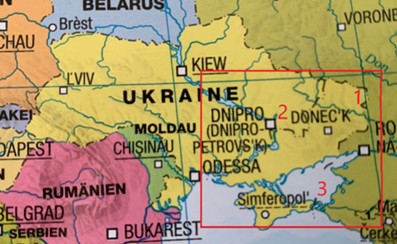
The range of map formats is extensive, including political maps, globes, atlases, and road maps. A minimum of six forms of misrepresentation exists, from labeling Crimea as “disputed” to acknowledging the 2022 “referendums”. The scale is vast, with erroneous maps of Ukraine being printed or sold by firms in the United States, the United Kingdom, Germany, Austria, and Italy. A distinct issue involves Google, which displays Crimea differently based on a user’s geographical location. In Russia, for instance, the peninsula is shown as Russian territory (or was previously).
In Ukraine, Google Maps portrays Crimea as separated from Russia by a solid line and from Ukraine by a faint dotted line.
On German Google Maps, prominent dotted lines demarcate Crimea from both Ukraine and Russia.
Companies infringe upon Ukraine’s territorial integrity despite the fact that the United States, Germany, and other countries where these businesses operate do not recognize Crimea as Russian or even “disputed” territory. The UN resolution on the territorial integrity of Ukraine passed in October 2022, garnered support from 143 countries. Russia, Belarus, North Korea, Syria, and Nicaragua were the only countries to oppose it. Moreover, only North Korea recognized Putin’s “referendums”, with Belarus refraining from officially recognizing Crimea as Russian.
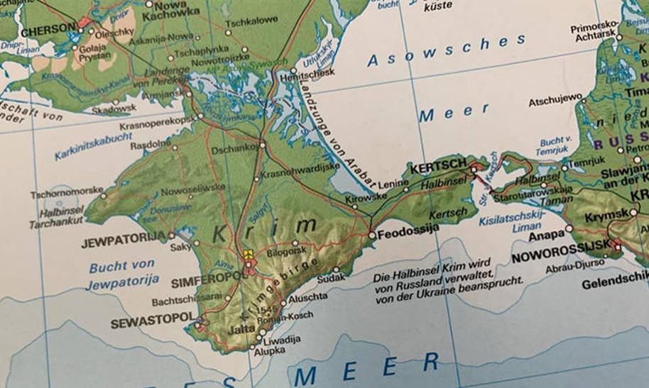
Despite this, numerous European firms continue to print maps depicting portions of Ukraine as “disputed” or Russian. For instance, Germany’s Mairdumont (and its subsidiary brands) indicates Russian “referendums” on some maps within Ukrainian territories occupied in 2022. Other manufacturers that disregard Ukraine’s territorial integrity include Columbus Verlag (Germany), Räthgloben 1917 Verlags (Germany), Tecnodidattica Spa (Italy), Edizioni White Star (Italy), Kunth Verlag (Germany), Freytag & Berndt (Austria), Hallwag Kümmerly+Frey (Switzerland), Interkart (Germany), and Stiefel Eurocart (Germany).
DuMont Reiseverlag’s map (a German Mairdumont brand) features Russian Crimea.
Distribution plays a significant role in addition to production. Several globally renowned companies offer their platforms or opt to sell maps that endorse Russian aggression. For example, maps with varying degrees of violations against Ukraine’s territorial integrity can be found on the German Amazon site or the online bookstore Bucher.de. Maps depicting Crimea as disputed or even Russian territory are sold on behalf of the American National Geographic. British Maps Worldwide sells maps from the Russian publisher AGT Geocenter.
Propaganda maps are also sold by Switzerland’s largest bookstore chain, Orell Füssli Thalia AG, the largest Austrian chain, Thalia.at (a subsidiary of the German giant Thalia.de), and the German chain Hugendubel.
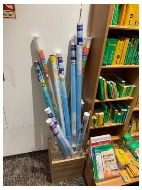
In the Thalia store located in Gera, Germany, four maps of Ukraine are available for purchase. Three of these maps depict Crimea as “disputed” or Russian, while only the smallest map accurately represents Ukraine’s borders.
Mykola Holubey’s research offers a comprehensive account of each point of sale and the maps available there. Altogether, six unique types of violations regarding Ukraine’s territorial integrity can be found across different maps and globes:
1. Ukraine and Crimea are shown in the same color, but a dotted border separates them, as seen on the ADAC Superstraßen 2023/2024 map Deutschland 1:200.000, Österreich, Schweiz 1:300.000 mit Europa 1:4.5 Mio.
2. Crimea is portrayed using colors of both Ukraine and Russia, as on the Kosmos globe - Kinder Globus - Entdecke deine Welt. Spezialeffekt im Dunkeln.
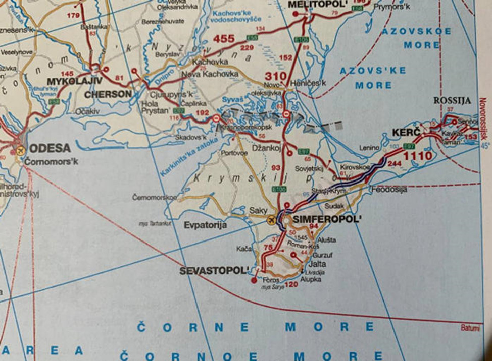
3. Crimea is depicted as part of Russia, like on the Marco Polo Kontinentalkarte Die Welt 1:30 Mio time zone map.
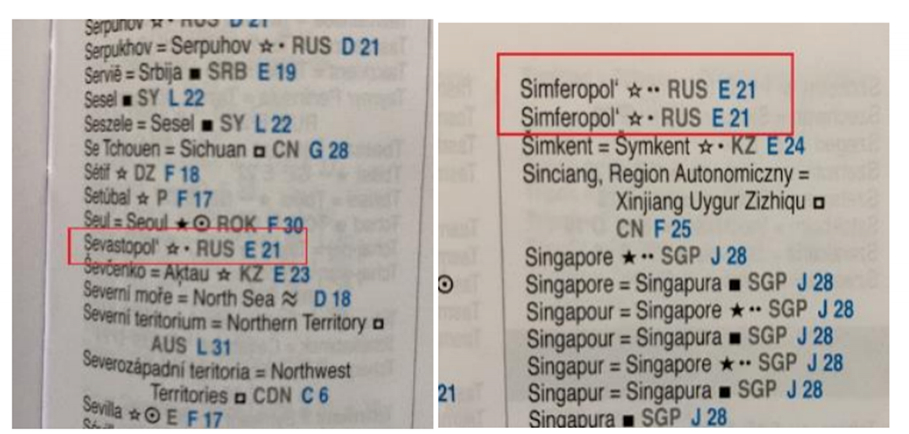
In the same edition, Sevastopol and Simferopol are listed as RUS in the list of cities in the world.
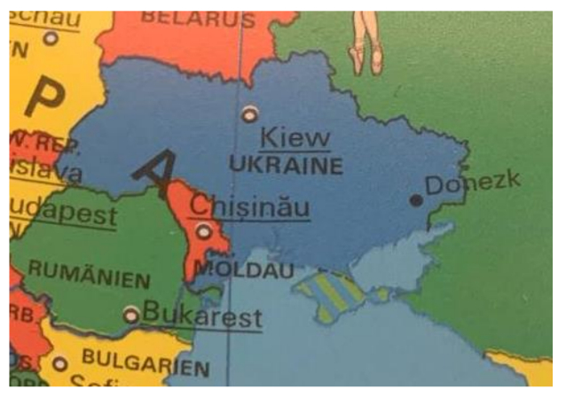
4. Crimea is labeled as Russian territory "claimed by Ukraine", as worded in Kosmos Weltatlas kompakt. Das aktuelle Bild unserer Erde, insinuating Ukraine as the aggressor, encroaching on a part of the Russian Federation.
5. Crimea and the territories of Ukraine occupied in 2022 are divided by a dotted line, as seen in the map of February 3, 2023, by Mairdumont. Marco Polo Weltkarte - Staaten der Erde mit Flaggen 1:35 Mio., plano in Hülse 120x80 cm.
6. On the Atmo Climate Globe. Klima Globus Crimea is "physically" (!) separated from Ukraine. The Perekop Isthmus, which connects mainland Ukraine with the peninsula, has been removed from the map. But the physical connection of Ukrainian Crimea with Russia in the Kerch region was retained.
Interestingly, some companies display different images of Ukraine on their websites and physical maps. For instance, the National Geographic Silver Classic globe on Räthgloben 1917 Verlags’ website displays the correct borders. Still, the physical globe Mykola Holubey received depicts Crimea in a different color, as a part of Russia. National Geographic Maps’ website also features separate maps with “Russian Crimea”.
It is difficult to overestimate the damage such maps do to Ukraine. They legitimize Russia’s occupation and give Russians fodder for propaganda: look, even National Geographic has recognized Crimea as Russian. They undermine support for Ukraine in the war by reinforcing the narrative that an attack on Crimea is an attack on Russia. They also distort the perception of Ukraine’s borders and territorial integrity for years to come.
Moreover, maps contribute to self-awareness and shape worldviews. For example, Chinese cartography is characterized by depicting China in the middle so that it truly looks like the Middle Kingdom. Cartographers shape our perception of the world. In colonial Europe, for example, maps were created that represented lands as inhabited or “no man’s land” (terra nullis), although the latter were actually inhabited by indigenous peoples. Such maps justified policies of colonization and deportation. Now maps are changing perspectives on Ukraine and justifying Russian aggression.
Ukraine has been facing similar stories since 2014. For example, the website of the Olympic Games published a map showing Crimea separated from Ukraine by a border; after a while, the map disappeared from the website altogether and then reappeared with corrections. The human rights organization Human Right Watch published a map of Ukraine without the Crimean peninsula in its daily summary; this discrepancy was noticed in the Ukrainian social media segment. The map of Ukraine was not changed after that but simply removed, and no comments were made. The New York Times published a map of Ukraine without Crimea, and after the Embassy of Ukraine in the United States contacted the editorial board, the border between Ukraine and Crimea started to appear dotted on the map. Similar cases occurred on the French TV channel Arte and in the newspaper Le Monde, as well as in the British BBC. Through Amazon, the German company Otto sold a gold pendant with a map of Ukraine that did not include Crimea. The Estonian Ministry of Education and Science was forced to withdraw from circulation an English language textbook that listed Crimea as part of Russia’s territory.
In fact, similar instances have even occurred within Ukraine. The “Council Secretariat” of the Lviv City Council uploaded a video on its official YouTube channel that displayed a map of Ukraine without the peninsula. The video was quickly taken down. Additionally, two Ukrainian history textbooks featured Ukraine without Crimea.
Such maps fail to represent the actual situation (for example, the previously mentioned Mairdumont map assigns even the unoccupied territories of Ukraine to Russia) and do not align with legal boundaries or internationally recognized borders. When something is stolen, and everyone is aware of the theft, it doesn’t become “disputed”, “theirs”, or something you “claim”. It remains your possession or, in the worst case, stolen property.
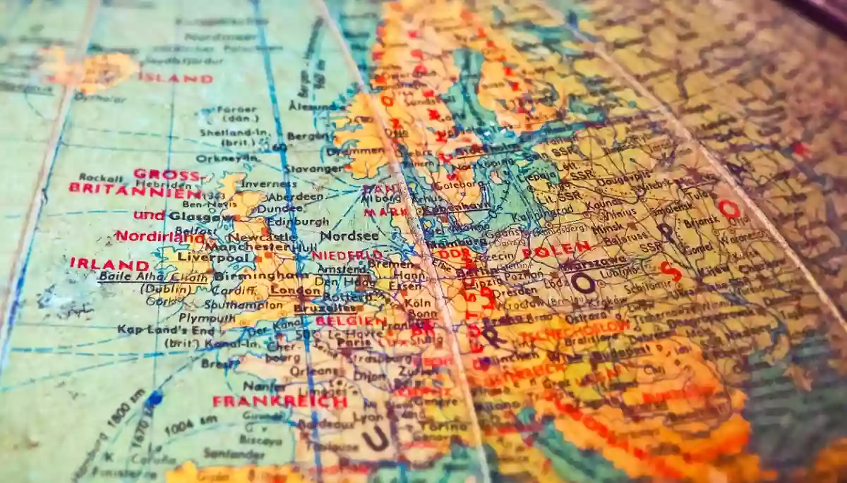
Photo: Michael Gaida / pixabay.com